
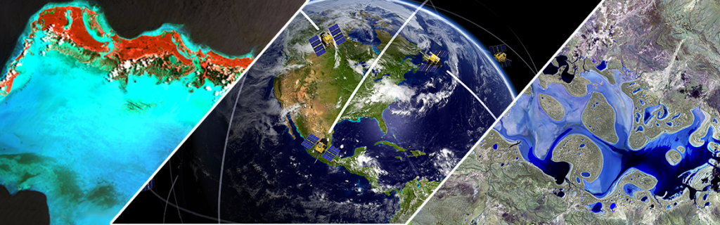
agriculture, water, forestry and geospatial technologies
SBI’s R & D endeavours fall into four broad categories
The trend towards estimating top soil moisture for agricultural fields using high resolution images from unmanned aerial vehicles (UAV) is accelerating. Such information is crucial for decisions on crop production and water resource management in precision agriculture. Aerial images are, however, expensive and not easily scalable, while radar images from satellites are affordable, easily scalable and regularly available because image acquisition is not affected by clouds.
Opting for easier and cheaper access to soil moisture information can increase the sustainable management of water resources, as well as food security on a global scale. Moreover, this information may also play a fundamental role in assisting resource managers and policy makers when dealing with topics relating to water, energy and food.
SAR images can also identify areas of low water storage capacity in the fields. The insights gained provide farmers with critical information for optimizing crop treatments and field expenses.

Long Term Average (LTA) of relative surface soil moisture content (LTA 1992 – 2000 January, Africa)
Implementation of satellite-image based strategies designed to optimize the use of fresh water in agriculture
Generally, agriculture and irrigation in particular consume over 80% of the world’s freshwater. Any attempt to improve water use efficiency in irrigated agriculture must be based on reliable estimates of seasonal/total evapotranspiration (ET), which has a major impact on water balance of plants.
Soil moisture provides conditions for evapotranspiration. If the soil is too dry, plants may easily be stressed due to the lack of available water. If we know the current precise evapotranspiration rate we will be able to help our customers to estimate the current water demands of the crop and arrive at a decision on whether to irrigate or not. The continuous monitoring of both the current status of crop health and evapotranspiration therefore forms the basis for optimizing irrigation and water management, and thus groundwater recharge.
In the adjacent illustration, we can observe that the vital biomass (VB) is higher but the actual evapotranspiration (AET) is lower, resulting in higher water productivity in January. This means less crop production costs in terms of water. On the other hand, higher VB and higher AET values result in lower water productivity in October and therefore higher crop production costs in terms of water. These results enable us to derive an optimization function of water consumption and crop productivity, resulting in more efficient crop and water management.

Remotely sensed crop productivity (Vital Biomass) and actual evapotranspiration (AET) for managing water in arid regions
Detection and analysis of field-level soil patches to supplement coarse level soil information in precision farming
The unavailability of high resolution soil information constitutes one of the major constraints in farm/field management. Many of our customers have identified this as a critical issue for optimizing field management costs. In order to address this issue, we have initiated a project with the aim of understanding field soil patches using satellite remote sensing. We train a machine learning algorithm to underpin a soil decision support system designed to develop a method which can supplement coarse soil information.

(A) Remotely sensed RGB image (B) Automatic field boundary detection (C) Automatic field-level soil patch detection
Crowdsourcing – pupils and students become citizen scientists
The project on data sourcing was launched in response to the hype triggered by geocaching, a recent trend which enjoys great popularity, especially with children, their parents and young people. The geocaching community and others are asked to take photos using their smart phones of agricultural fields and send or upload these on a web portal.
As young people are well connected in social networks and are used to sharing information instantaneously and globally, they are naturally predestined to become citizen scientists. The educational aspects are taken care of by involving teachers from secondary schools and academics from universities. Their common task is to teach pupils/students in the framework of their school/university education how to base satellite image analyses on ground-truth data which can be used to derive sophisticated satellite image products.
All those involved familiarize themselves with today’s agricultural issues and the latest opportunities of earth observation techniques.

Crowdsourcing and crowd science
Ocean Color Remote Sensing as a diagnostic tool for eutrophication due to agricultural practice
Freshwater runoff contaminated with agriculture-derived nutrients (nitrogen, phosphate and sulfur) causes an increase in nutrient levels (eutrophication) in the coastal waters. This stimulates large biological productivity (i.e. phytoplankton blooms) in a nitrogen-limited coastal area. Runoff exerts a strong, consistent influence on biological processes, stimulating blooms within days of fertilization and irrigation of agricultural fields in 80% of cases. The concentration of these chemicals can directly affect biodiversity or lead to chemical imbalances in the environment which ultimately kill individuals, species and habitats..
The continuous monitoring of the main optical components (coloured dissolved organic matter, chlorophyll, diffuse attenuation coefficient) of coastal water can help policy makers to safeguard coastal water quality, thereby ensuring a sustainable and healthy coastal ecosystem. This project of ours is intended to develop a coastal water monitoring system, with the potential to become one of the key instruments in protecting water against agricultural pressures.

Ocean Color Remote Sensing as diagnostic tool for eutrophication
Groundwater depletion monitoring and sustainable agriculture water management
The steady increase in the demand for food is associated with the pressure of finite water resources. Indeed, the unavailability of water is a major obstacle to achieving agricultural sustainability and securing the availability of food in arid and semi-arid regions. Across the world more than 80% of the total groundwater is consumed by agriculture. By 2050 there will be nine billion people to feed. Having a sufficient supply of food will depend upon ensuring sufficient water to grow crops and produce high yields.
A sustainable water management plan can ensure agricultural water optimization. When drawing up a sensible water management plan, we first need to know what amount of freshwater reserves we have in terms of surface/ground water. In arid and semi-arid regions the only source of water is the ground water. In a second step, it is essential to assess the agricultural water productivity of the annual (e.g. wheat, corn) and biennial (e.g. alfalfa) crops cultivated under center pivot irrigation.
Gravity Recovery and Climate Experiment (GRACE) can estimate changes in the amount of water stored in a region, which causes shifts in the earth’s gravity field. The GRACE Follow-On (GRACE-FO) satellite mission, with a tentative launch date set in 2017, ensures the sustainability of such an idea.

Groundwater depletion monitoring using GRACE satellites to monitor the total mass change in Saudi Arabia.
Inter-sensor TOA reflectance comparison for ensuring different satellite image derived vegetation index interoperability
Interoperability denotes a property of a product or system featuring interfaces which have been fully understood, allowing it to work with other products or systems, now or in the future, without any restrictions on access or implementations.
Satellite image commercialization ensures high spatial and temporal resolutions for our customers. Understanding and developing a processing routine for inter-sensor compatibility/comparability enable different satellite-sourced data assimilation. This, in turn, ensures the higher availability of our regular products in an efficient manner, while allowing us to improve our flexibility to deliver appropriate satellite-image based products to our customers based on the capability of combining commercial and free satellite data.

Potential of SAR and optical image fusion for improving forest biomass estimations – within the framework of REDD
Forests are one of the cost effective ways of decreasing the concentration of CO² in the atmosphere due their natural ability as biomass to store carbon. Forest biomass estimation is also essential for regional carbon accounting. An accurate estimation of forest biomass is therefore necessary for monitoring the global carbon cycle and changes in this cycle.
We are investigating possibilities for accurately estimating biomass by combining SAR and optical images in different regions. In running projects of this kind, our aim is to develop an automated procedure which can be easily tuned to accommodate specific regions/countries/continents based on forest characteristics. Upon completion of the project, we intend to develop a carbon budget approach to facilitate efficient carbon tax management.

(A) Sigma0 VV (B) Sigma0 VH (C) Sigma0 HV (D) Sigma0 HH (E) RGB (VV, HV, HH) image interpretation: HV polarization represents the volume scattering. Accordingly, the green colour in the image represents the volume of leaves on the trees and plants.
SBI’s research & development program
Our in-house R&D programme was created with the aim of recognizing the mutually beneficial relationship which exists between ourselves and our customers. We would love to hear from you, especially about the challenges you might be facing or your dreams and ambitions. You never know – we might be able to help.